Tom’s Raritan River
Railroad Page
www.RaritanRiver-RR.com
12 Nov
2005
By Don Zrebiec
For the fourth time
in as many years several of us that frequent the forums at http://www.raritanriverrailroad.com
(thanks again Webmaster Joe!) got together to see what’s left of the old
RRRR. Last year Nikcap,
RRRR4, Tom, Pennsyjohn, and I walked from the
Sayreville side of the
We walked from the
site of the Crossman Company at the rear of
The ground we covered
is highlighted on the below 1947 RRRR system map (Figure 1) and local map
(Figure 2). The yellow numbers on the
local map are tied to the section numbering used throughout this report.
![]()
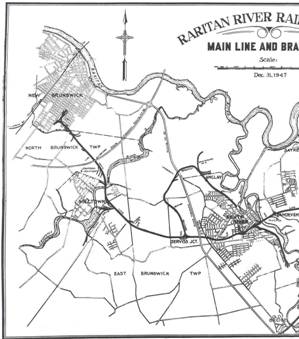
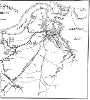
Figure 1 – RRRR System Map Showing Track Covered During RRRR Field Trip
#4
1 2 3 4 5 6 7 8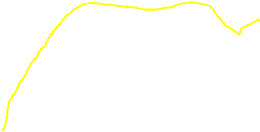
![]()
![]()
![]()
![]()
Figure 2 – Local Map With Numbered Points of
Interest During RRRR Field Trip #4
When we met at
#1) Crossman Company – Our first stop was just behind
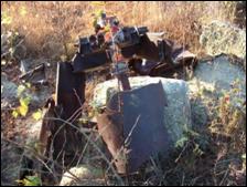
Figures 3, 4, & 5 – Crossman’s Ruins
After the ruins we
set out to locate the right-of-way (ROW) of track that served Crossman’s. We were interested in this ROW since we believe
it was part of the original ROW prior to a track relocation that occurred in
this area in the late 1930’s. The ROW
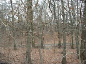
was still visible as a path through the woods (Figure 6) as well as evidenced
by the many ties we found still in the ground.
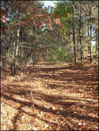
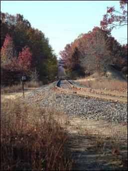
Figure 6 – ROW of RRRR Track that Served Crossman’s
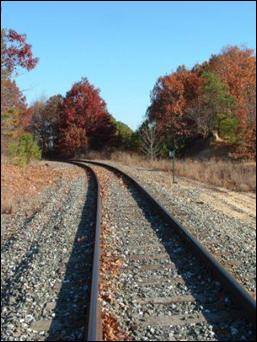
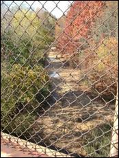
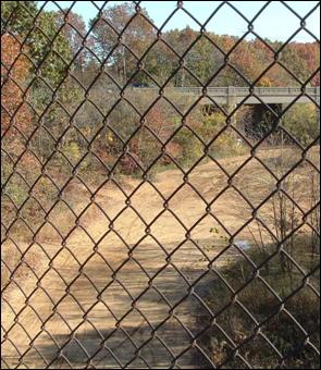
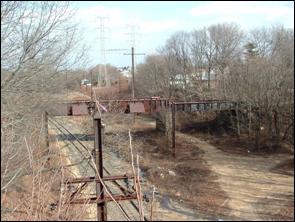
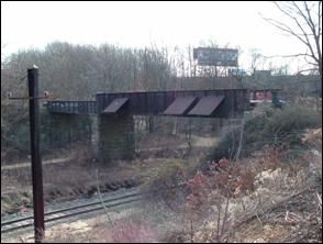
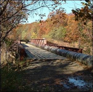
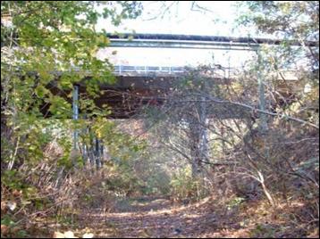
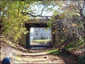
#2) Bridge at
We walked about a
quarter mile to the bridge over
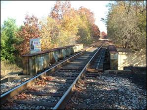
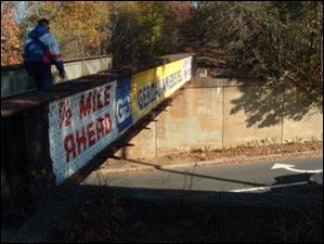
Figures 7 &
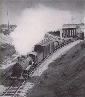
I know of no evidence
that suggests two sets of track ever crossed this location. Perhaps at the time of the bridge’s
construction RRRR management was planning for possible future expansion. The only other track that I know ran through
this area was the Public Service trolley which crossed the RRRR track at grade
before the
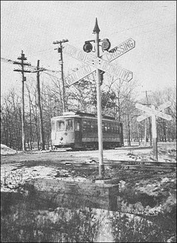
Figure 9 – Public Service Trolley at Roberts Crossing (Today’s
#3)
Figures 10 & 11 –
We decided to save
exploration of the Kearney Spur for a later date. We left the active track and began the final
two mile walk into South Amboy via the old mainline’s
ROW. This brought us into an area of
some new businesses and warehouses which were built on the old ROW. Also, the ROW was breeched by the
construction of
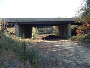
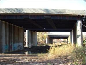
Figures 12 &
On the nearest
overpass in Figure 13 you can see two metal structures attached to the bottom
of and perpendicular to the road deck (i.e., parallel to the ROW). These structures are also barely visible on
the nearest southbound overpass. I found
out that these two overpasses predated the other two and were the original
overpasses built when the GSP was constructed in the mid 1950’s. The other two overpasses were built at a
later time (in fact, the RRRR helped deliver some of their major structural
members). We theorized the purpose for
these structures were to deflect the exhaust of the steam locomotives. Although the RRRR stopped using steam in 1954
engineering plans for the overpasses were probably drawn up at a time when
steam was still running on the RRRR.
When the two later overpasses were built steam was long gone from the
RRRR so such structures were not needed.
The location of these
GSP overpasses also coincides with one end of the RRRR’s
Penn Cut Siding. This siding began
immediately after the
However, when the
hoppers containing the ilmenite leaked a bit, the ilmenite would form little black mounds which strikingly
looked like gunpowder to the kid I was at the time. I recall my friends and I
discovering these little piles and then collecting and secreting the material
away to a more “secure” site where we tried to light it off. It’s a good thing it wasn’t gunpowder as we
most certainly would have hurt ourselves if it was.
A bit further down
the line we crossed the South Amboy city line at the
Figures 14 & 15 – Then & Now of ROW Between
GSP (in background) and
Figures 16 & 17 – Then & Now Between
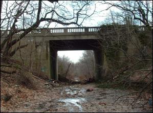
Next along our path
was the Route 9/35 overpass (Figure 18).
This photo was taken pointing deeper into South Amboy with Bergen Hill
only about 500 feet past this overpass.
To the right of this photo is a sandy, hilly area where I had my first
and last ride on a 3-wheel ATV. I almost
flipped over while going down a rutted hill.
A large part of my potential mishap was due of my inexperience on the
thing, but it sure seemed inherently unstable when going downhill and
turning. That experience gave me a
better understanding of why they probably made 3-wheelers illegal.
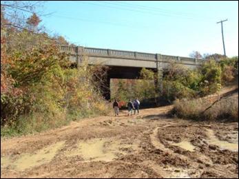
Figure 18 – Route 9/35 Overpass
Just to the left
after passing under this overpass the RRRR had a few short storage tracks next
to the Penn Cut Siding. I’m not old
enough to recall seeing cars parked on these tracks but I do recall the tracks
being there 30 years ago. In fact, I was
able to find some rail in the vicinity (see Figure 19) so I assuming these are
the remains of these short tracks.
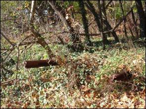
Figure 19 – Possible Storage Track Rails Near
the Beginning of the Penn Cut Siding
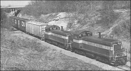
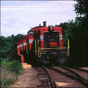
Just after snapping
the above photo I heard the familiar bellow of diesel locomotives. Hopping out of the woods (and probably to the
surprise of my fellow hikers) I made a bee-line to the
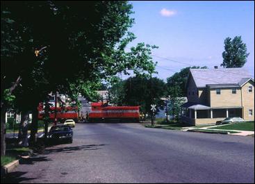
Figures 20 & 21 – Train on the Amboy Secondary Heading for Browns
Yard
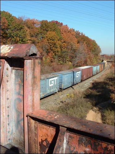
Figure 22 – Train on the Amboy Secondary as Seen from the RRRR’s Bergen Hill Bridge
#5) Bergen Hill – We all had our hangouts as kids. Mine was Bergen Hill.
I had relatives and a
very good friend that lived at the end of
Bergen Hill had a
passenger station, a few derailments, was the origin of a connection to the
Pennsylvania Railroad (PRR), and was the location of the demise on the RRRR’s swiftest steam locomotive. Oh yeah, and there’s a 132 foot Cooper E60
(i.e., limitation of 6,000 lbs per linear foot) bridge there that us locals
named “The Red Bridge” (Figure 23).
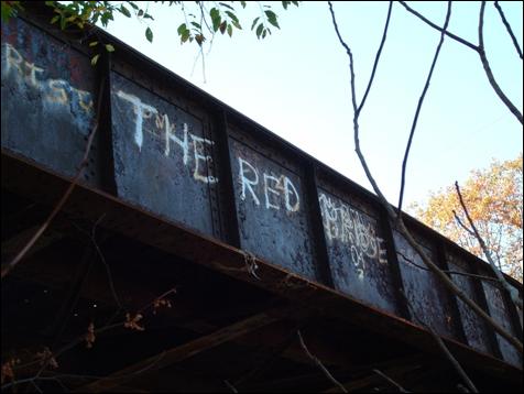
Figure 23 – East Side of Bergen Hill’s “
The
The PRR maintained a
large yard in this area primarily to store cars destined for the coal docks on
the
Figures 24 & 25 – West and East Sides of the
If I correctly
remember the date that was on the builder’s plate, the
Figures 26 & 27 – Then (by Robert A. Staples) & Now Pictures of
the
After we completed
our inspections of the
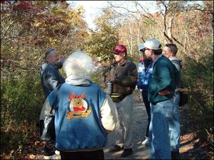
Figure 28 – The Gang at Bergen Hill
In Figure 26 you can
see a switch that begins immediately at the end of the bridge. This is the track that headed up a grade under
Route 9/35 to a small yard (see Figure 29 from Page 39 of RUTR) paralleled
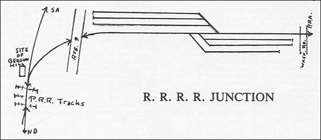
Figure 29 – Sketch of RRRR Junction
We didn’t walk this
stretch of ROW but I have some pictures I took during a previous day of
exploring. The track on the other end of
the yard crossed over
![]()
![]()
![]()
![]()
![]()
Figures 30 & 31 – Grade Descending to RRRR Junction with the PRR
Anyway…getting back
to Bergen Hill, the best photo I have ever seen of the Bergen Hill Station is
used at the bottom of Page 74 of RUTR (Figure 32).
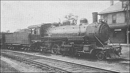
Figure 32 – RRRR #10 at the Bergen Hill Station
I know this station
was used for passenger service but I’m not sure if it had any freight use. If it didn’t, and since passenger service on
the RRRR ended in 1938, I doubt this building saw much action after that
date. I think I recall hearing that the
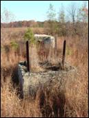
building was either torn down or burned down sometime in the early 1940’s. All that now remains of the station is its
foundation (Figure 33), hidden by overgrowth, leaves, & branches perhaps 25
feet from the old ROW. (If you’re
interested, Webmaster Joe posted a separate story I wrote about the Bergen Hill
Station at http://www.raritanriverrailroad.com/bhs.htm.)
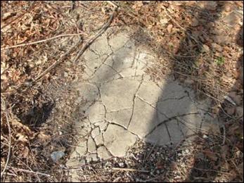
Figure 33 – Bergen Hill Station Foundation
Now, regarding that
switch just off the bridge in Figure 26, there’s a bit of a story to be told…a
story about the demise of RRRR Locomotive #15, a Baldwin 4-6-2.
On 12 Oct 1948 this
locomotive, the RRRR’s only Pacific-class locomotive,
came off the tracks at Bergen Hill. Part
of #15’s run for that day involved getting some cars eastward over the
![]()
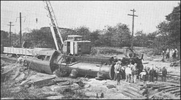
Figure 34 – RRRR #15 Accident at Bergen Hill
Since the RRRR had
recently obtained seven US Army surplus 0-6-0’s that
were at most six years old, Mr. Harold Filskov (the RRRR Vice President and
General Manager) decided to have the 32 year old #15 cut up on the spot.
It is sad looking at
#15 in Figure 34, but that photo has an obscure tidbit of information to
offer. The yellow box in Figure 34
surrounds a concrete drainage culvert/pipe.
As it turns out, this structure still exists at Bergen Hill and is shown
in Figure 35 (that is, if you ignore the poison ivy, the leaves, the sapling in
the center of the photo, and the white piece of cardboard at top center). This culvert/pipe allowed us to virtually
pinpoint the spot at which #15 rested on its final day of work for the
RRRR. In fact, Figure 28 was taken with
us standing virtually on the same spot that #15 fell.
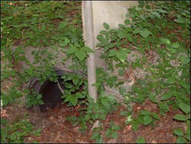
Figure 35 – Drainage Culvert/Pipe at Bergen Hill
Other occurrences at
Bergen Hill: I remember seeing a newspaper article regarding a boxcar
derailment in the area, but there was one other potentially more serious
incident that occurred at the
In closing with
respect to Bergen Hill, I’d like to share a memory that’s nearly 30 years
old. A good friend of mine and I used to
enjoy finding empty bottles, setting them up on a sand embankment next to the
RRRR tracks at Bergen Hill, and then throwing stones at them. It may sound boring, but in our minds we were
firing lasers (stones) at an attacking force of Cylon
Raiders (bottles) as we tried to protect Battlestar Galactica (us). One
day we had about 80 bottles set up on that hill when a RRRR SW-900 came across
the
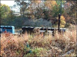
Figure
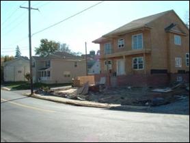
One can’t help but
notice the new home built on the ROW near the
Figure
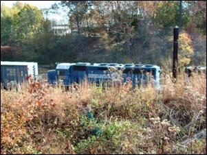
We made our way up
onto the
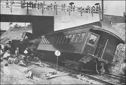
Figure 40 – Wreck at
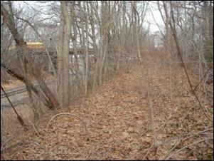
We left the
Figure
Several years ago
many homes were built on
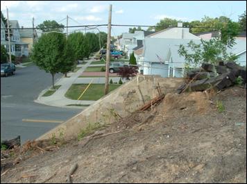
Figure 43 – Homes on
From
Figure
We briefly split up
at this point with RRRR4 and me trying to follow the old ROW while the others
walked up
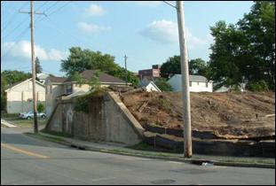
#7) South Amboy Shop Area – As far as I know the RRRR had a
shop in this area since Day 1. However,
the shops most widely recognized are those constructed in 1919. This included the main shop, a 12-stall
roundhouse, a turntable, and various outlying buildings. The 12-stall roundhouse was reduced to seven
stalls in 1945 and completely eliminated along with the turntable and other
buildings in the mid-1950’s. The main shop (Figure 45) served the RRRR
into the Conrail years.
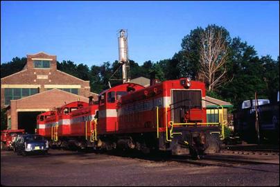
Figure 45 – RRRR Shops (by Robert A. Staples, 09 Jun 1980)
After a few years of
disuse the main shop burned on 28 Jul 1983.
Whatever remained was razed shortly thereafter. Figure 46 shows the floor of the main shop as
we found it during our hike.
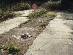
Figure 46 – Remains of RRRR Shop Floor
Figures 47 & 48
respectively show aerial views of the shop area around 1970 and today (the
facility at the top of each picture is South Amboy’s Frog Hollow Swim
Club). The rear wall of the roundhouse
is easily discernible in the bottom section of Figure 47 but is barely
perceptible in Figure 48.
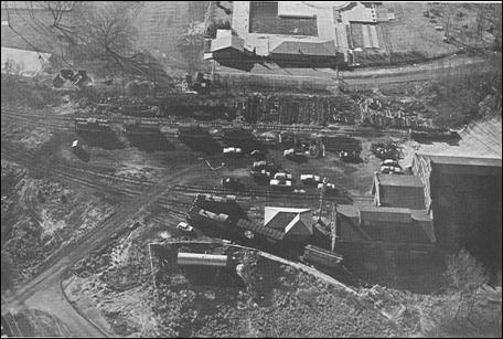
Figure 47 – RRRR Shop Area Circa 1970 (Page 55
from RUTR)
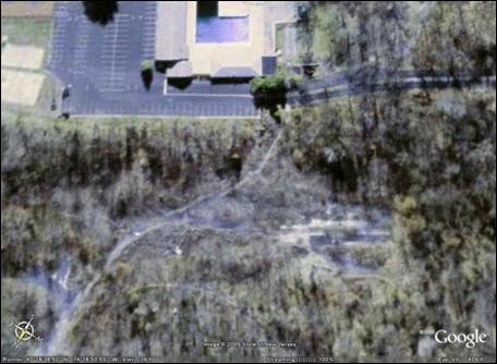
Figure 48 – RRRR Shop Area Now
Figure 49 (taken in
Jan 2004) shows a rear portion of the roundhouse wall as can be seen today.
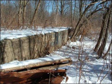
Figure 49 – Remains of Rear Wall of the Roundhouse
The supports for the
diesel fuel tank (Figure 50, also taken in Jan 2004) still remain. The tank is the cylindrical object near the
bottom of Figure 47. Also remaining is
the foundation for the sanding tower (Figure 51 [note the silver tower in the
center of Figure 45]).
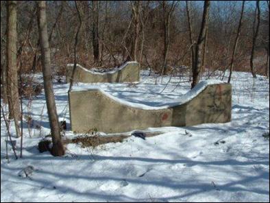
Figure 50 – Supports for Diesel Fuel Tank
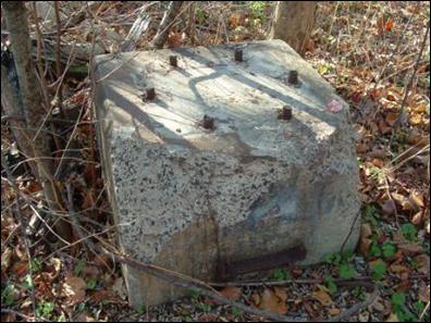
Figure 51 – Sanding Tower Foundation
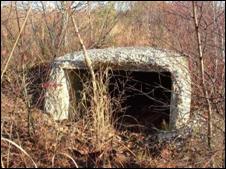
As for the
turntable…we went to great lengths to pinpoint its exact location. The best we could estimate is that it stood
where a small warehouse-of-sorts occupied some of the old RRRR property in the
1980’s and 1990’s. This warehouse was
removed about five years ago and all that remains is
its floor (see Figure 52). Our best clue that we were in the right area for the turntable was
the house in the background in the center of Figure 52. This is the same house seen above RRRR #19 in
the popular 1953 Homer Hill postcard (Figure 53).
Figures 52 & 53 – Now & Then for the RRRR Turntable
We left the shop area
and headed toward the RRRR’s old connection with the
New York & Long Branch (today’s NJ Transits NJCL). Figure 54 shows the remains of the RRRR’s Broadway grade crossing (the NJCL is to the left) as
it existed in Feb 2004. However, this
stretch of Broadway was recently re-graded & resurfaced as part of the new
grade crossing being installed across the NJCL a few hundred feet ahead and to
the left in Figure 54. There goes one
more trace of the RRRR’s existence!
Figure 54 – Remains of Broadway Grade Crossing (Feb 2004)
#8) Downtown South Amboy (RRRR Main Office) – The RRRR
maintained its official office on the northeast corner of Broadway and
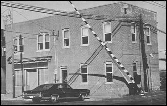
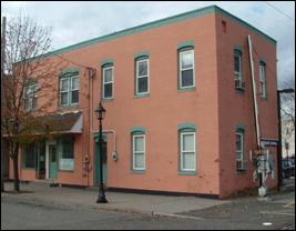
Figure 55 – RRRR Main Office Then Figure 56 – Ex-RRRR Main Office
Now
We didn’t spend too
much time here since there wasn’t much to see with respect to the RRRR. Before leaving the area at about 3:30PM I
grabbed one other shot to create another then & now scene. Figure 57 is from Page 68 of RUTR while
Figure 58 is an image of the same spot today.
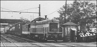
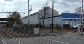
Figure 57 – RRRR at John St Crossing Then Figure
Finale) A Visit With Mr. Kipp – A
nice end to our hike was an offer by Mr. Robert Kipp,
the RRRR’s last Vice President and General Manager,
to visit him at his house. Mr. Kipp’s warm welcome and his offering of pastries and coffee
were very much appreciated. However, we
all became so engrossed in Mr. Kipp’s RRRR collection
that I don’t think any of us actually ate or drank anything!
Mr. Kipp was ready for us as he had his slide projector set up
and ready to go. We spent at least three
hours at Mr. Kipp’s and must have gone through at
least 200 slides, seeing tons of RRRR pictures we had never seen before. The ones that got the biggest reaction from
the crowd were those of Caboose #5 as it was craned out of the
The only sad
announcement during our visit with Mr. Kipp was when
he relayed the news that Mr. Charles A. Miller, the RRRR’s
last General Agent, had passed away just a few days before. Our condolences go to the Miller family and
especially to Mr. Miller’s son who recently joined us in the RRRR Forum.
EPILOGUE
Like all of the RRRR
Field Trips before, this one likewise showed and taught us a few new things
about the RRRR. It also fostered camaraderie,
and if nothing else, reassured each of us that we’re not the only “RRRR Nuts”
out there.
Now that we’ve walked
the entire line I suppose any future outings will cover parts of the ROW we
didn’t have time to explore before (e.g., the Gillespie Spur, the Kearney Spur,
RRRR Junction, etc.). However, the next
thing on the horizon is the formation of the Raritan River Rail Road Historical
Society (RRRRHS)…Coming in 2006!
By Don Zrebiec
Written 12 Jan 2006
Other
Fine Sites Dedicated to the
http://www.geocities.com/transit383/rrhist.html
http://jcrhs.org/raritanriver.html
Here is an entire forum dedicated to
discussions of the RRRR!
www.railroad-line.com/forum/forum.asp?forum_id=2